BEST 4 NATIONAL / STATE PARKS TO VISIT NEAR SAN FRANCISCO


If you’re looking for active, outdoorsy things to do near San Francisco, this is the page for you.
I’ve made a list of the four best National/ State Parks to visit north of San Francisco with directions on how to get to them. Each destination is less than two hours from the city.
MUIR WOODS (35 mins)

Muir Woods is probably the most popular California bucket list destination. Walk among giant redwood trees that make you constantly look to the sky. Its proximity to San Francisco makes it one of the most convenient destinations for visitors. The oldest tree is roughly 1,200 years and the tallest around 258 ft tall. It’s a grounding experience. There are several hiking trails in this park. I suggest getting a trails map for $1 at the entrance of the park or download the desired trails for the routes you plan to hike before your trip (there is no cell service).
Directions: Enter “Muir Woods National Monument” in maps. There is a designated parking lot with limited space. You need to make a reservation online BEFORE you go, otherwise you will not be allowed into the lot. There is NO other parking nearby. You could park at Muir Beach but it’s a 3 mile hike to the park from there; you will be tired before entering the park. I definitely recommend parking in the designated lot.
The parking pass costs $8; to purchase one go to: gomuirwoods.com. To skip the lines you can also purchase entrance tickets for $11 on this website.
2. POINT REYES (1.5 hrs)

Point Reyes Beach

Point Reyes Lighthouse - featured in 80s horror film “The Fog”
Point Reyes National Seashore is a gorgeous peninsula offering all the moody Pacific North West vibes without leaving the Bay Area. There are multiple coastline hikes to choose from (check out @alltrails ), stunning beach views, and a charming lighthouse (featured in the 1980 horror film “The Fog”).
BONUS spot! Make sure you stop at Cypress tree tunnel (pictured below) on your drive out to Point Reyes! This spot is so photogenic and dreamy looking.. take a look below!
Directions: Enter “Point Reyes Lighthouse” in maps. At the end of the road, you will come to a roundabout, where you will find a free designated parking lot on your left. Park the car and walk about a half mile to the lighthouse. At the time of this blog (Sept 19 2021), the lighthouse is temporarily closed. It is still possible to get to the overlook where you can enjoy incredible scenic views of the peninsula.
For the tree canopy, enter “Cypress Tree Tunnel” in maps. Keep driving a short distance past this destination and you will find a free dedicated parking lot on your right.

Cypress Tree Tunnel
3. MOUNT TAMALPAIS (45 mins)

Trojan Point Mt Tamalpais
Mt. Tamalpais is known for above the clouds views. When the Marine Layer is in full effect (which it almost always is especially in the mornings), consider a mini road trip here.
Directions: Enter “Trojan Point” in maps. Drive past the curve with the tree on your left, and you will find a free parking lot on your right. If you want to capture this aerial shot of the winding road, you need to place your camera on the hill north from this road. Make sure you remote has good range if you’re traveling alone. Most good ones do.
4. MARIN HEADLANDS (20 mins)
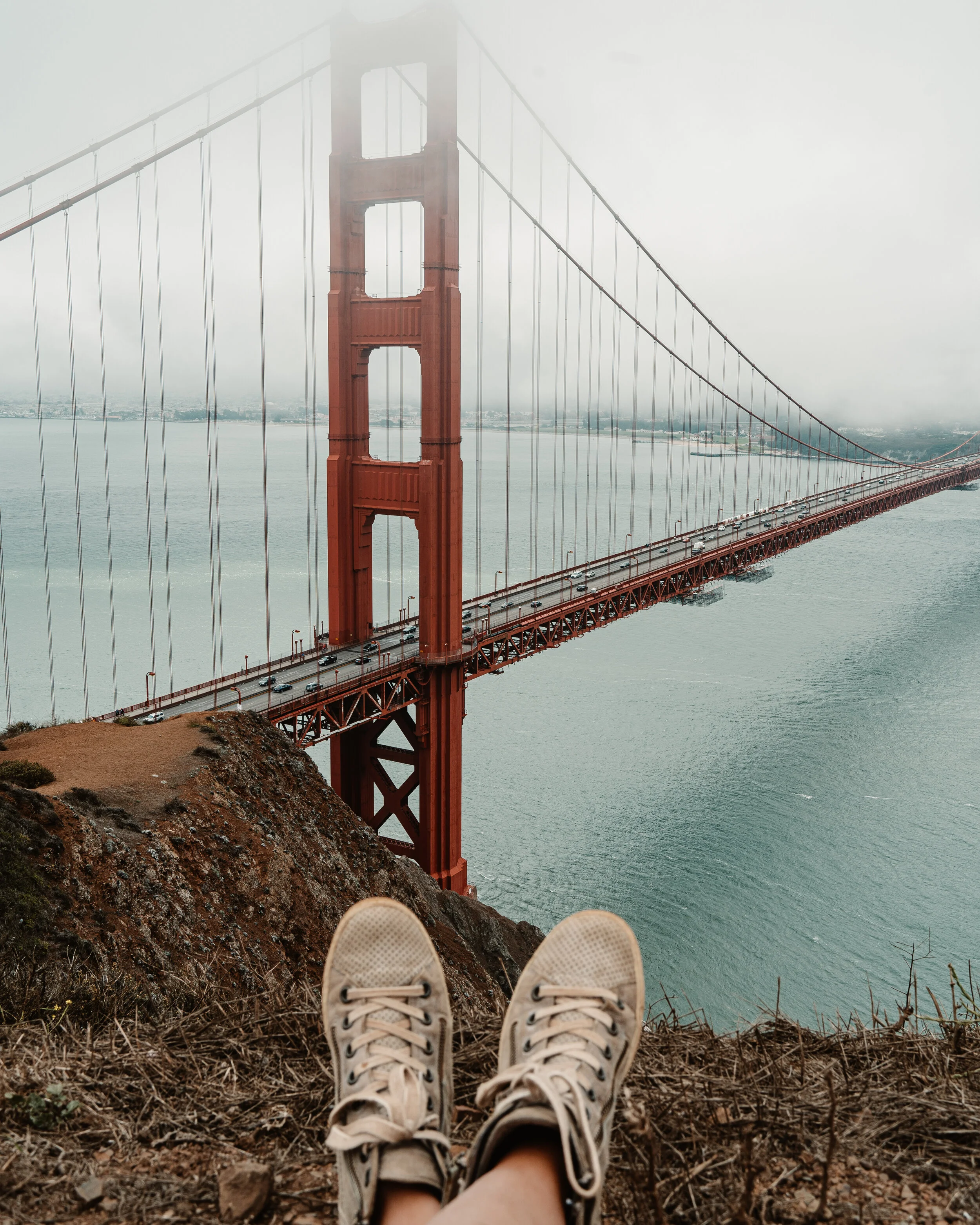
Battery Spencer - Golden Gate Bridge View
Marin Headlands (20 mins): closest spot to the city, just over the Golden Gate Bridge. It offers some of the best views of the bridge, along with hiking trails and cliffside beaches such as Kirby Cove, Rodeo Beach and Black Sands Beach. I personally recommend Kirby Cove. It combines a hike, a beach and stunning views of the Golden Gate Bridge. Bonus: there’s a cute swing that is very IG-able. The steep, mile-long trail down to the cove begins at the parking area at Battery Spencer on Conzelman Road. Once you reach the bottom of Marin Headlands, turn left and walk along the beach until you see the tree that the swing hangs from.
For the best places to view and photograph the Golden Gate Bridge, check out this list here.
Directions: Enter “Battery Spencer” in maps. You can park on Conzelman Road (for free), but the lookout point from the top is a popular tourist destination so parking may be tough during peak hours (weekends and sunset). With Battery Spencer to your left, continue slightly past it and you will see a trailhead sign with directions for Kirby Cove.
Things to know before you go:
Go on a weekday (if you can) for a more relaxed, less crowded experience.
Bring layers! The Bay Area & beyond is famous for its micro-climates. The temperature can drop by 10 degrees within minutes. Make sure you bring a sweater or light puffer jacket that you can tie around your waist or stuff into a backpack.
There is bad to no cell service in some of the parks. Download an offline version of maps to your phone for later use.
Leave no trace. There are often no trash cans in these parks, so please pack in what you pack out. Let’s keep these places beautiful and wild.


